Los Angeles Map - Stockillustratie
A detailed map of the central area of Los Angeles, including Downtown, Hollywood, and Beverly Hills as well as areas south of Interstate 10. Includes major roads as well as highways, freeways, neighborhoods and points of interest, all on separate layers. An extra-large JPG is included so you can crop in to the area you need.

Bestel uw ingelijste foto direct en bekijk de diverse opties op Photos.com.
LICENTIE KOPEN
Alle royalty free licenties bieden wereldwijde gebruiksrechten en uitgebreide bescherming. Daarnaast zijn er eenvoudige tarieven met volumekortingen beschikbaar.
€ 335,00
EUR
Getty ImagesLos Angeles Map, Stockfoto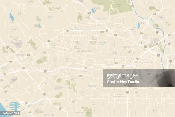 Download premium, authentieke Los Angeles Map stockillustraties van Getty Images. Verken vergelijkbare stockillustraties met hoge resolutie in onze uitgebreide visuele catalogus.Product #:165726700
Download premium, authentieke Los Angeles Map stockillustraties van Getty Images. Verken vergelijkbare stockillustraties met hoge resolutie in onze uitgebreide visuele catalogus.Product #:165726700€335€50
Getty Images
In stockGEGEVENS
Credits:
Creatief nr.:
165726700
Soort licentie:
Collectie:
DigitalVision Vectors
Max. bestandsgrootte:
5564 x 3738 px (47,11 x 31,65 cm) - 300 dpi - 4 MB
Datum van uploaden:
Release-informatie:
Model en property release
Categorieën:
- Kaart,
- De stad Los Angeles,
- Los Angeles County,
- Stadsplattegrond,
- Wegenkaart,
- Vectorafbeelding,
- Californië,
- Beverly Hills - Californië,
- Hollywood - Californië,
- Santa Monica,
- Binnenstad,
- Rodeo Drive,
- Westwood - Los Angeles,
- Illustratie,
- Verenigde Staten,
- Autosnelweg,
- Meerdere baans snelweg,
- Stad,
- Sunset Boulevard - Los Angeles,
- Sunset Strip,
- University of Southern California,
- Venice - Californië,
- West-Hollywood,
- Bel Air,
- Cartografie,
- Century City,
- Chinatown,
- Culver City,
- Dodger Stadium,
- Griffith Park,
- Melrose Avenue,
- Santa Monica Boulevard,
- Silver Lake - Stad Los Angeles,
- Straat,
- Vervoer,
- Weg,
- Wilshire Boulevard,
- Zonder mensen,