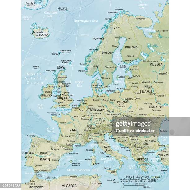
Fysieke kaart van Europa - Stockillustratie
Vector illustration of the physical map of Europe
Reference map was created by the US Central Intelligence Agency and is available as a public domain map at the University of Texas Libraries website.
https://www.cia.gov/library/publications/resources/the-world-factbook/graphics/ref_maps/physical/pdf/europe.pdf

Bestel uw ingelijste foto direct en bekijk de diverse opties op Photos.com.
LICENTIE KOPEN
Alle royalty free licenties bieden wereldwijde gebruiksrechten en uitgebreide bescherming. Daarnaast zijn er eenvoudige tarieven met volumekortingen beschikbaar.
€ 335,00
EUR
Getty ImagesFysieke Kaart Van Europa, Stockfoto Download premium, authentieke Fysieke kaart van Europa stockillustraties van Getty Images. Verken vergelijkbare stockillustraties met hoge resolutie in onze uitgebreide visuele catalogus.Product #:995921286
 Download premium, authentieke Fysieke kaart van Europa stockillustraties van Getty Images. Verken vergelijkbare stockillustraties met hoge resolutie in onze uitgebreide visuele catalogus.Product #:995921286
€335€50
Getty Images
In stockGEGEVENS
Credits:
Creatief nr.:
995921286
Soort licentie:
Collectie:
DigitalVision Vectors
Max. bestandsgrootte:
2800 x 2800 px (23,71 x 23,71 cm) - 300 dpi - 18 MB
Datum van uploaden:
Locatie:
Spain
Release-informatie:
Geen release vereist
Categorieën:
- Kaart,
- Europa - Geografische locatie,
- Zweden,
- Wereldkaart,
- Frankrijk,
- Politiek,
- Spanje,
- Fysische geografie,
- Duitsland,
- Cartografie,
- Reliëfkaart,
- Vectorafbeelding,
- Noord-Atlantische oceaan,
- Topografie,
- Fysische kaart,
- Italië,
- Rivier,
- Gegevens,
- Middellandse zee,
- Ontwerpelement,
- Overheid,
- Silhouet,
- Sociaal netwerk,
- Avontuur,
- Bedrijfsleven,
- Begrippen,
- Bergketen,
- Bord - Bericht,
- Creativiteit,
- Delen - Wiskunde,
- Eiland,
- Exploratie,
- Globale communicatie,
- Idee,
- Ierland,
- Illustratie,
- Image-based social media,
- Infographic,
- Land,
- Omtrek,
- Politiek en staatsbestuur,
- Reis,
- Rijksgrens,
- Symbool,
- Techniek,
- Vervoer,
- Vierkant - Compositie,
- Zee,
- Zwarte zee,